


prev
KVI NOTARY OFFICE
TREPTOW-KÖPENICK | BERLIN
Plot Area: ca. 15.5 ha
Student Competition, Third Best Student Project 2011
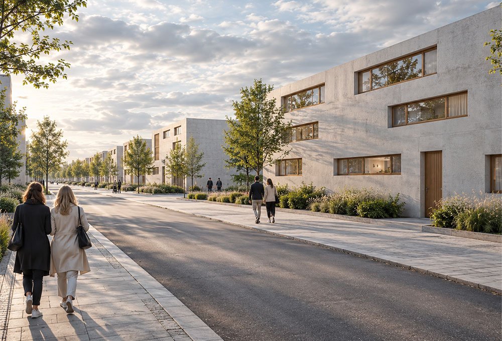
Treptow-Köpenick is a mixed-use masterplanning competition on approximately 15.5 hectares in suburban Berlin. The site is connected to the Spree and sits within a borough known for low population density, historical attractions and growing housing demand.
The proposal responds to Berlin’s urbanisation and immigration by addressing the need for quality housing while creating a new destination for Treptow-Köpenick. The site is connected by the Spree, buses, tram and the surrounding road network.
The analysis identifies glass as a symbol of transparency and integrity and proposes it as an important structural element. The meeting of Wendenschloßstraße and Pritstabelstraße establishes a strong axis, reinforced by the rhythm of existing neighbourhood blocks.
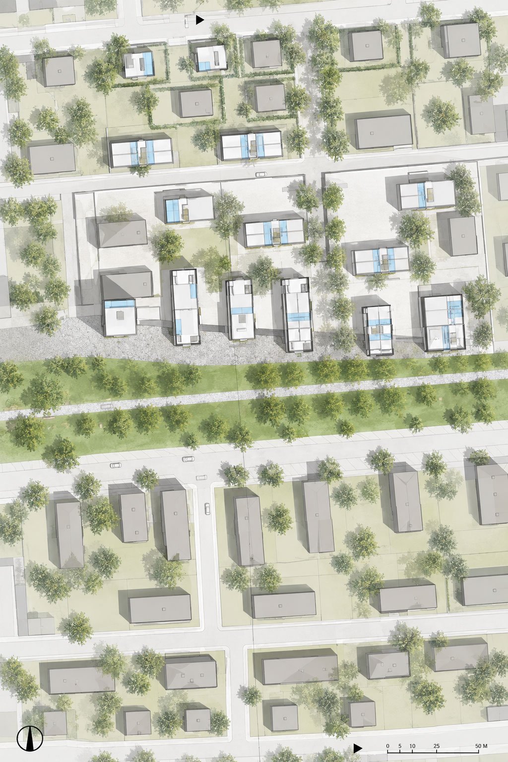
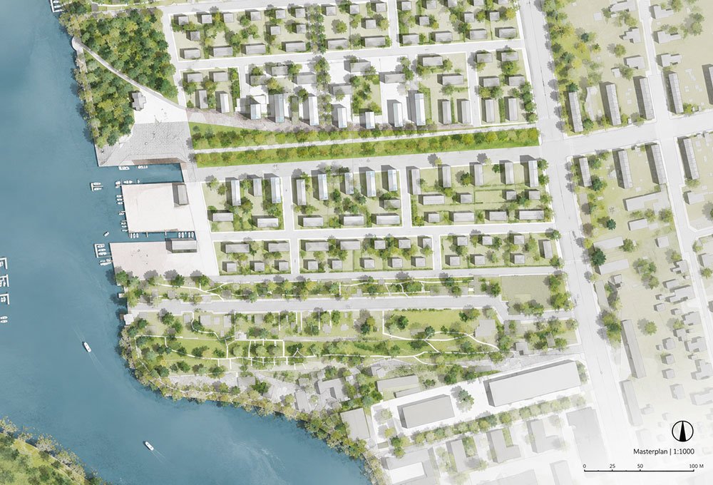
The “Zipper” concept creates a connected sequence of activities from land to water. Building blocks open toward the Spree to maximise views, while a central heritage walkway connects to the street; a public plaza and water-activity centre anchor the shoreline.
Site Analysis: Connection & Axis
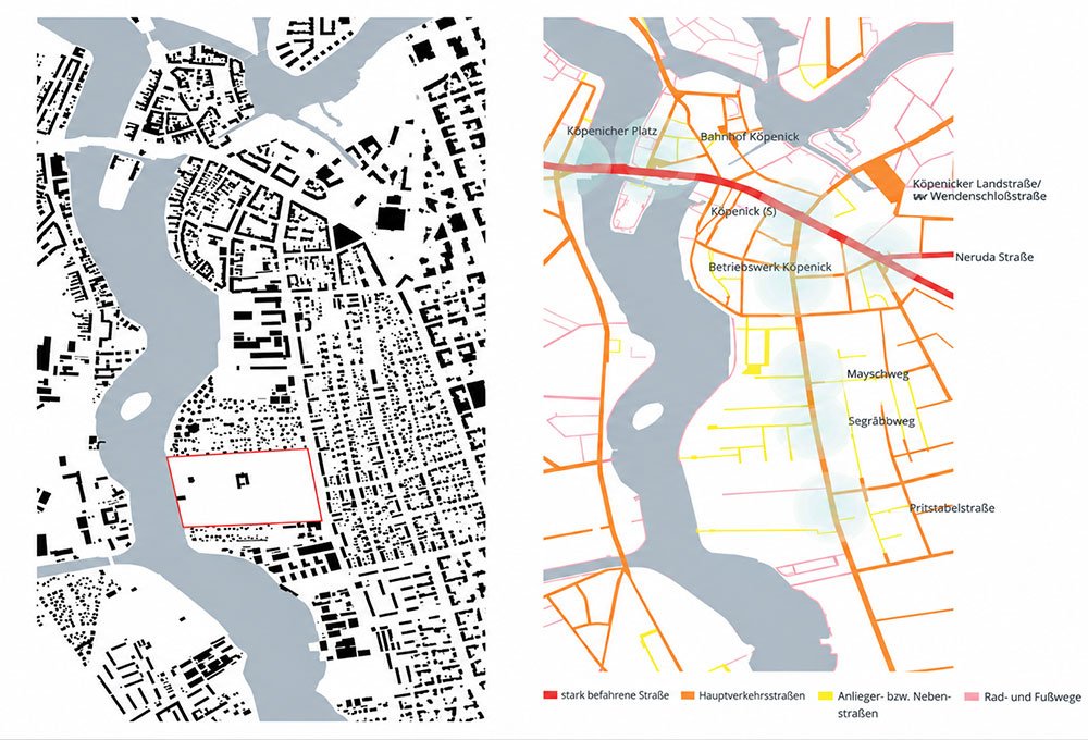
The site's relationship with both land and water forms the foundation of the masterplan. Its connections to the Spree River, public transport, and the surrounding road network provide opportunities to strengthen accessibility and establish a more integrated urban structure.
A key organizing element emerges where Wendenschloßstraße meets Pritstabelstraße, forming an axis that extends into the site. This axis, together with the existing neighborhood's block patterns, informs the spatial organization of the proposal and establishes a framework for connecting the surrounding urban fabric to the river.
The Concept: The Zipper
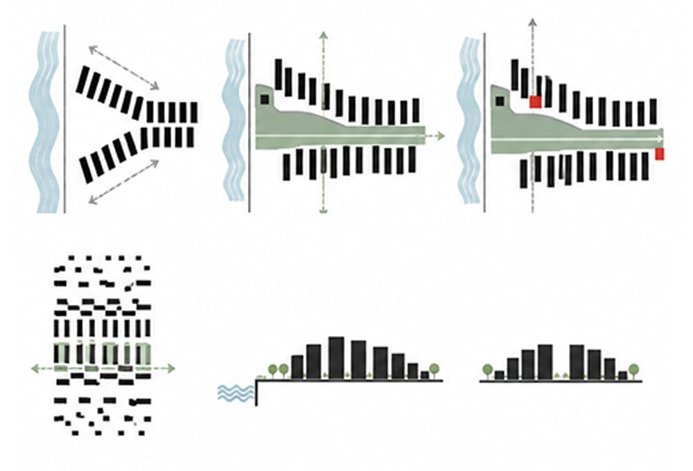
The central concept, “The Zipper,” transforms the site's main axis into a connected sequence of activities extending from the neighborhood toward the Spree waterfront.
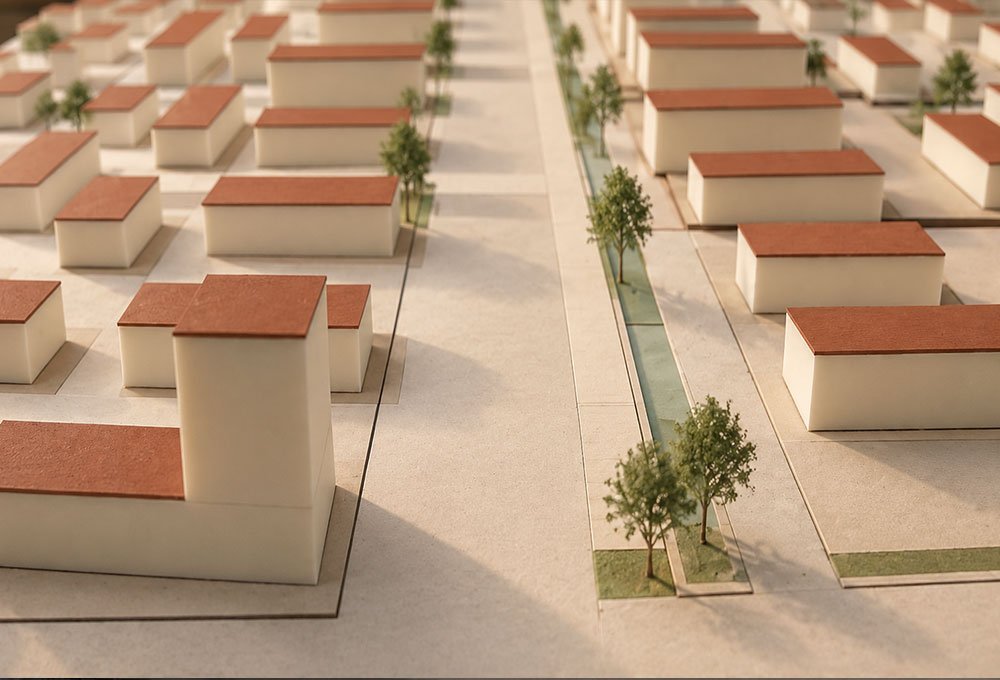
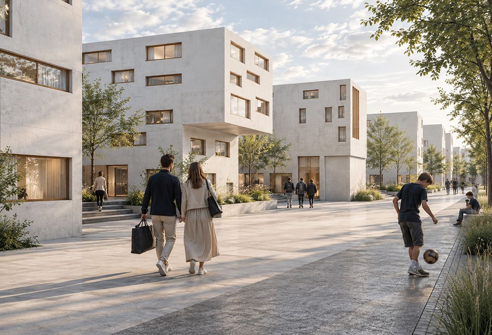
Along this axis, building blocks are progressively staggered and opened toward the river, creating a rhythm of built and open spaces while maximizing views toward the water. The axis also builds upon an existing heritage walkway through the middle of the site and connects it to Pritstabelstraße, strengthening the relationship between the new development and its surroundings.
As the axis approaches the shoreline, it culminates in a public plaza that serves as a focal point for waterfront activities. Designed as a shared destination, the plaza accommodates water-based recreation, including canoeing, motorboating, and gondola activities.

Building Formation: Defining Orientation & Privacy
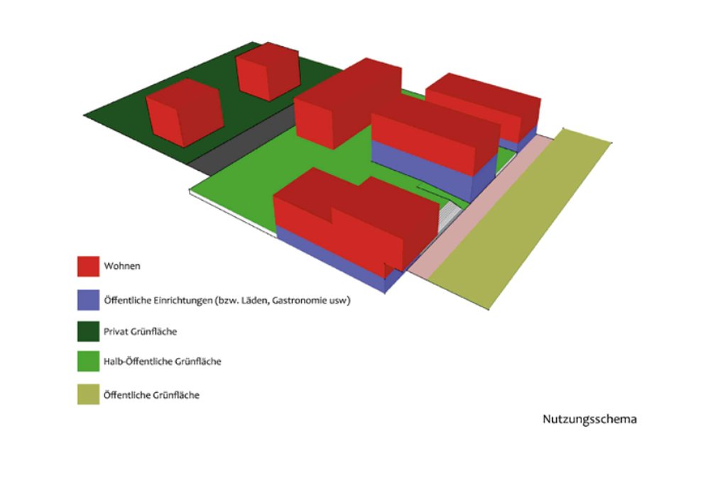
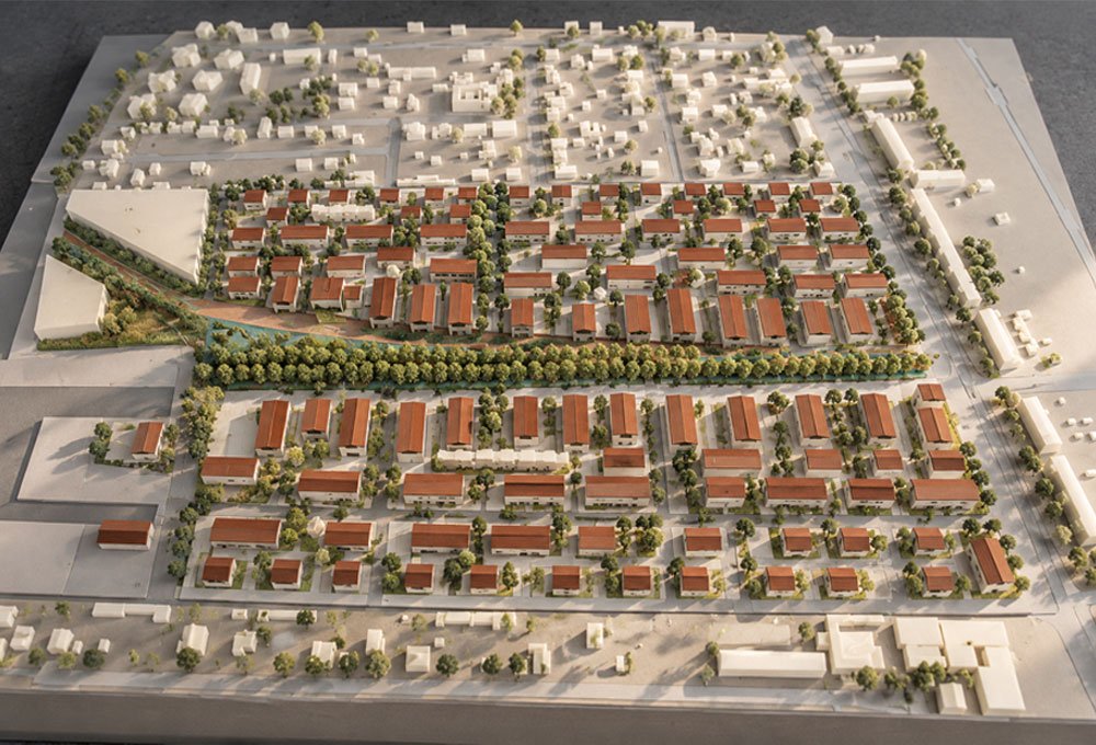
The arrangement of the building masses reinforces the central axis and establishes a clear spatial hierarchy across the site. Two taller buildings are positioned on either side to define the overall orientation, while the central building arrangement is set perpendicular to the green belt.
Further from the green belt, the buildings shift into a looser, more parallel configuration, allowing greater separation and a more private residential environment. This transition creates a gradient from the shared public realm toward more intimate residential spaces, balancing urban connectivity with the need for privacy.
Through the interplay of the central axis, staggered building blocks, green belt, and public waterfront plaza, the masterplan establishes a framework for connecting housing with public life.
Rather than treating the river as the edge of the development, the proposal positions it as an integral part of the neighborhood experience. The Zipper becomes the connective structure that brings together movement, housing, landscape, and waterfront activities, creating a new urban destination rooted in its relationship with the Spree.