



prev
TREPTOW-KÖPENICK | BERLIN
MATA TAYAN | KAPUAS TAYAN
WITH STUDIOKOTA | Plot Area: ca. 17.5 ha
National Competition, Second Prize | Winner Masterplan Kapuas Tayan
Mata Tayan | Kapuas Tayan is a 17.5-hectare mixed-use masterplanning competition associated with the Kapuas Tayan Bridge. The proposal considers the island’s strategic position within the Trans Kalimantan network and its potential as a regional logistics, distribution and activity centre.
The bridge connects Kalimantan through the Kapuas River and Tayan Island and strengthens the route toward the Indonesia–Malaysia border. The development is framed by the Sanggau district masterplan and the wider transportation strategy of Trans Kalimantan.
The proposal uses the new cloverleaf interchange as a catalyst for Tayan Island, transforming a former ferry-dependent location into a rest area and tourism destination. Public facilities include bridge maintenance support, restaurants and creative shops while recognising Dayak, Malay and Chinese cultural communities.
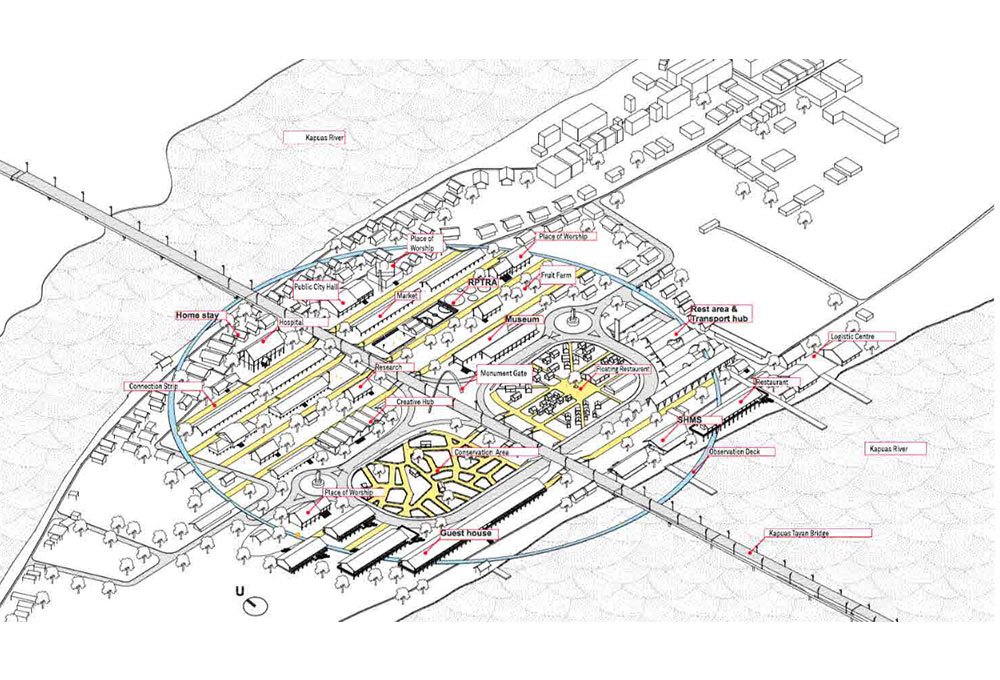
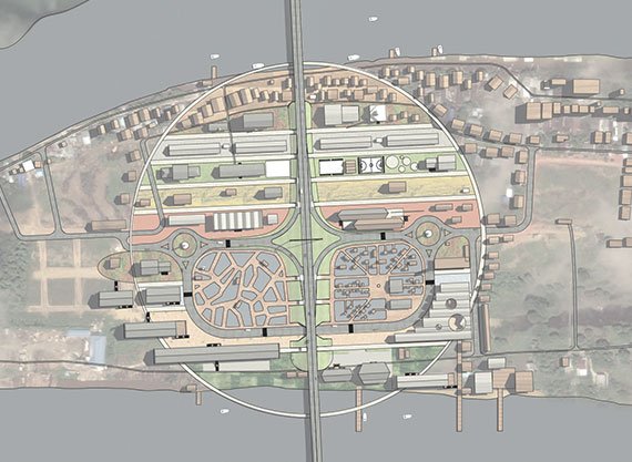
The concept reconnects the island after the bridge divided it into east and west. New links and tunnel strips connect four main zones, with uses graduating from more private local-community programs in the north toward public restaurants, museums and guest houses facing the bridge and water in the south.


The Concept: Reconnection & a New Core
Before the bridge was constructed, Tayan Island functioned as a relatively independent territory, with its main settlements concentrated along the northern coast and access primarily dependent on ferries and boats. The bridge and its cloverleaf interchange subsequently divided the island into eastern and western parts, while the main access road created another division between the northern and southern areas.
The masterplan responds by re-establishing connections across these fragmented territories. A series of tunnels beneath the bridge infrastructure creates new links between the four main zones, allowing movement to flow across the island rather than being interrupted by the transportation corridor.
At the heart of the proposal, a central development core acts as a catalyst for growth, extending its influence from the island's middle toward the surrounding coastlines. The core establishes a new spatial structure that brings together circulation, public facilities, commercial activities, and cultural programs.
A Gradient from Local Life to Public Activity
The masterplan organizes its programs through a gradual transition from private, community-oriented functions in the north to more public and visitor-oriented activities in the south. The northern zone accommodates local housing, guest homestays, schools, healthcare, civic facilities, and community markets, supporting the everyday needs of Tayan's residents.
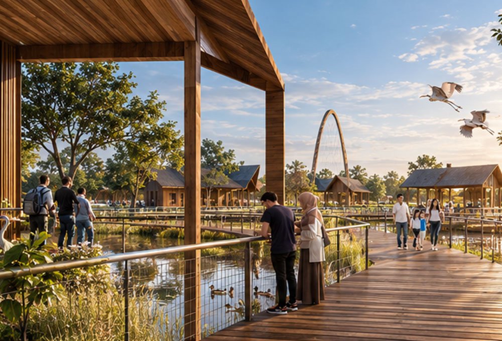
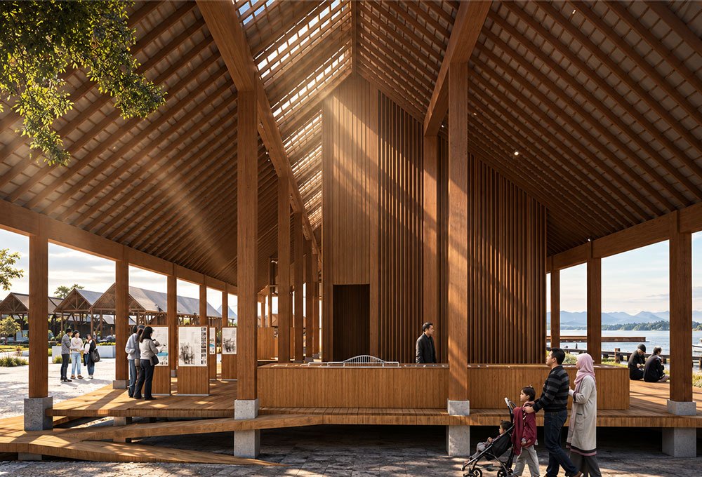
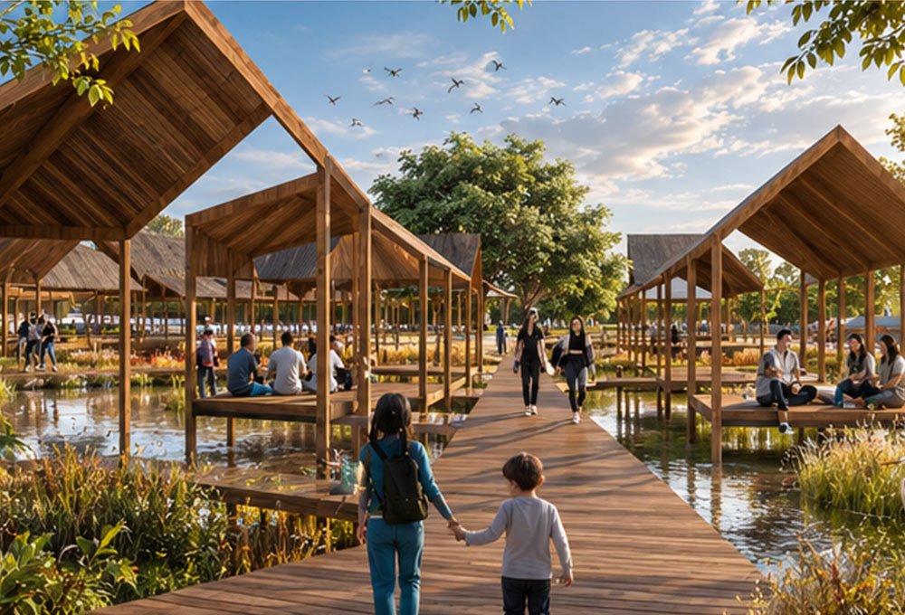
Toward the southern waterfront, the development becomes more publicly accessible, introducing hospitality, restaurants, creative retail, cultural facilities, museums, and festival spaces. Positioned to benefit from views toward the Kapuas Tayan Bridge and the river landscape, these destinations create opportunities for visitors to experience the island beyond its role as a transportation checkpoint.

Infrastructure as a Catalyst for Community
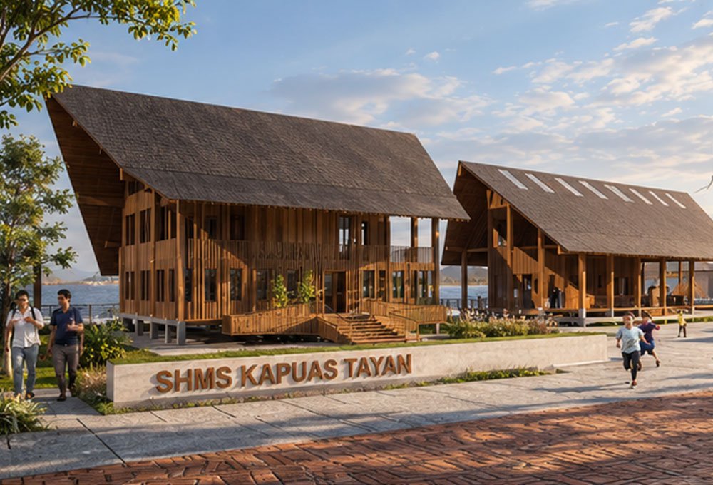
A key component of the proposal is the System Health Monitoring System (SHMS), a facility supporting the maintenance and monitoring of the Kapuas Tayan Bridge. Rather than treating it as an isolated technical facility, the design integrates the SHMS with complementary public functions, including a tourist information centre, restaurants, retail spaces, and a creative hub for local businesses.
The architectural program is distributed across three buildings to maintain a balanced scale and a clear hierarchy of access. Office functions occupy the more private domain, recreation and education form a semi-private zone, while gastronomy and retail activate the public realm. Together, these facilities create a more engaging environment for both residents and travellers.
Mata Tayan seeks to transform the impact of major infrastructure into a lasting opportunity for community development. By reconnecting the island, establishing a central development core, and integrating local facilities with tourism and cultural activities, the masterplan proposes a more cohesive relationship between mobility, public life, and the river landscape.
Rooted in the cultural diversity of Tayan's Dayak, Malay, and Chinese communities, the proposal aims to create a destination that supports local livelihoods while celebrating the island's distinctive identity.
The vision is to make Tayan Island more than a passage between destinations—a place where people, river, and culture come together to shape a resilient future.